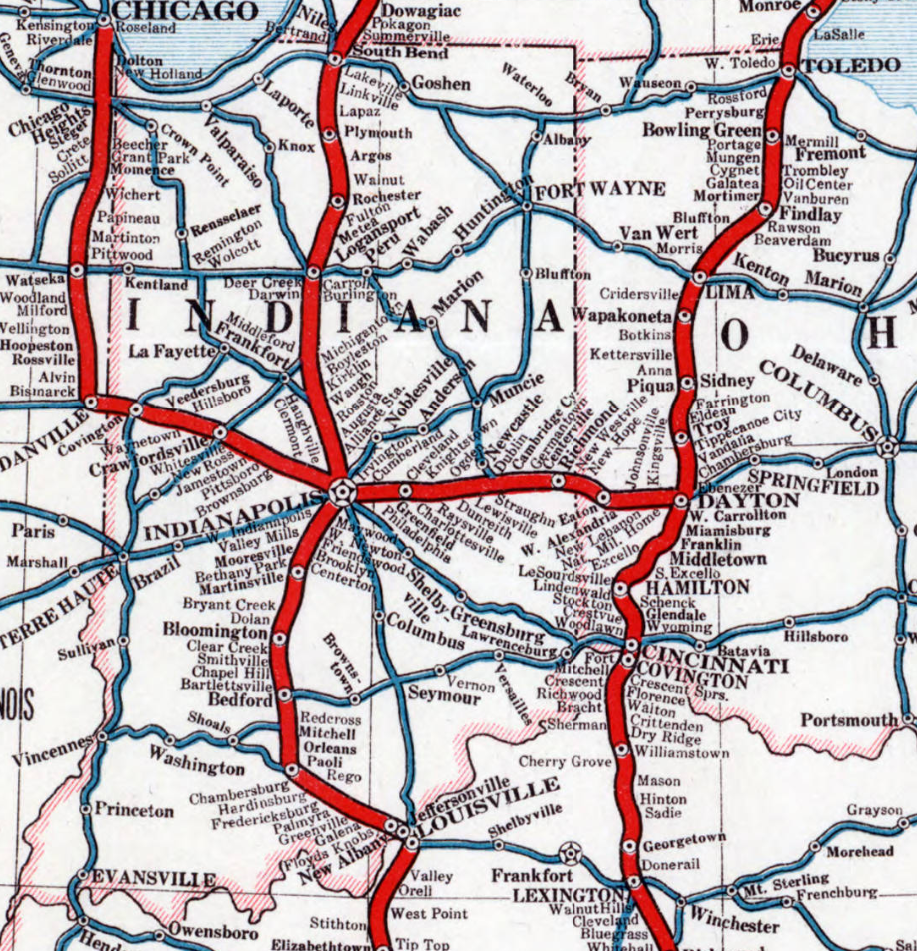
Dixie Highway Map (Indiana) (1916) North to south – from Indiana-Michigan state line south:
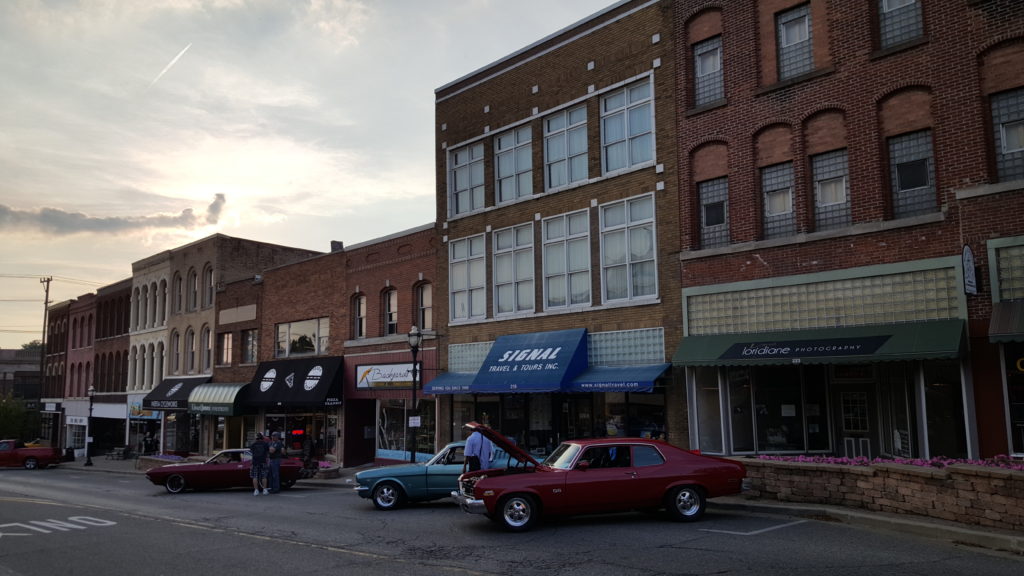
Classic Car Show, Downtown Niles Niles, Michigan
Michigan-Indiana state line
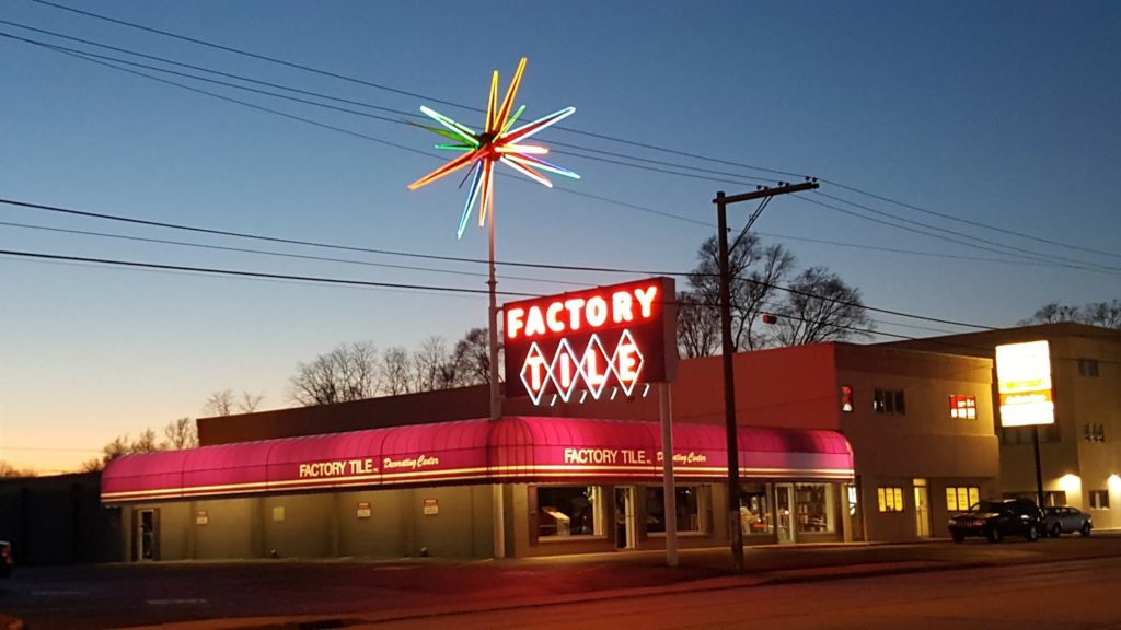
Factory Tile at dusk, S.R.-933 (Old U.S. Route 31), Roseland, Indiana Roseland
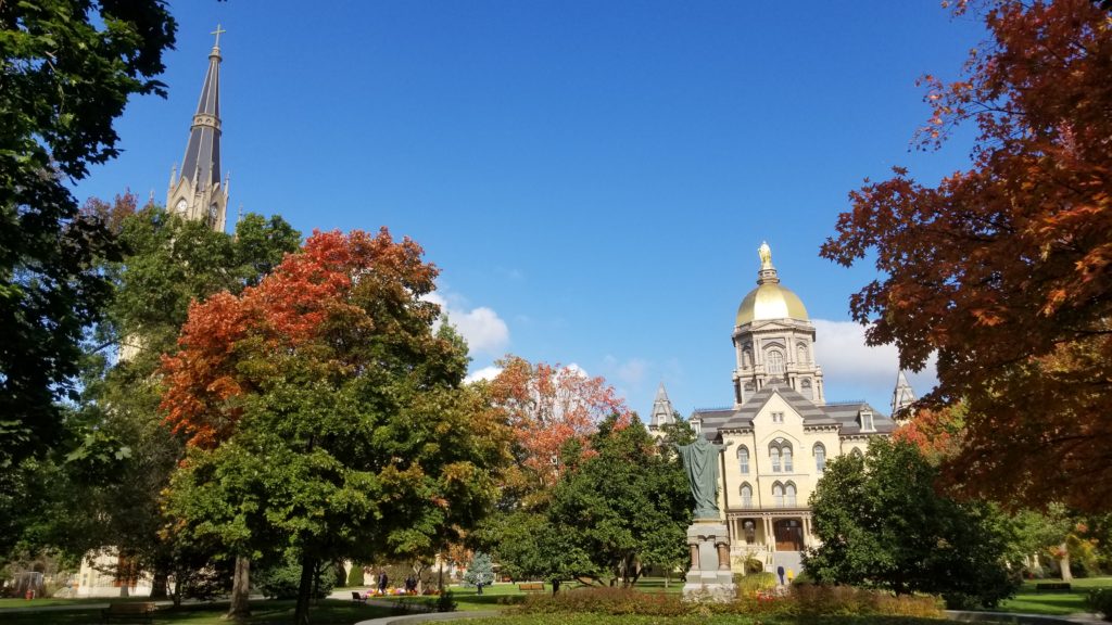
University of Notre Dame Notre Dame
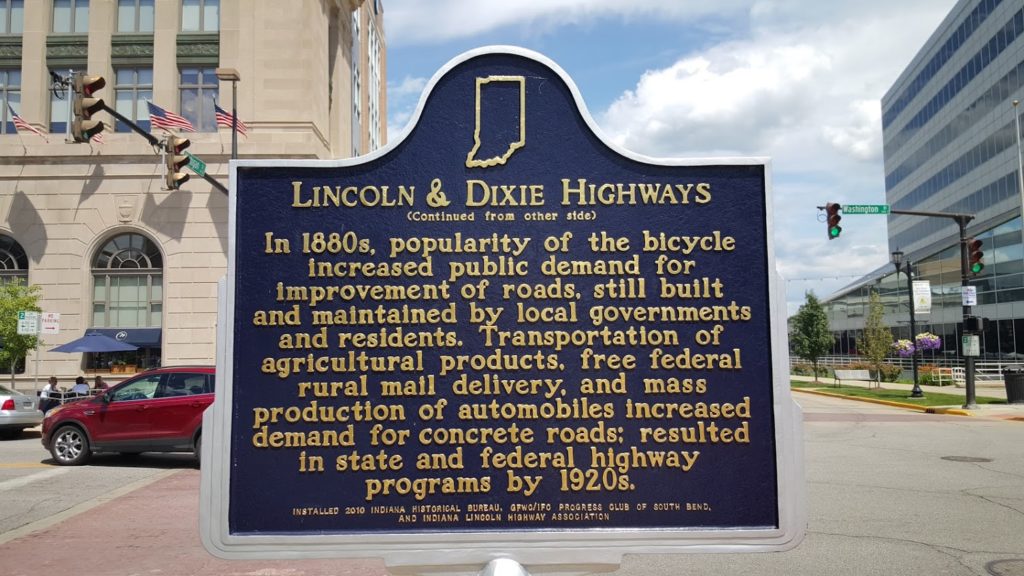
Lincoln-Dixie Highways Historic Marker, South Bend Lincoln Highway, Michigan Road, Dixie Highway, and Detroit-Lincoln-Denver Highway – road markers of historic auto routes established by the early 1920’s South Bend – crossroad of Lincoln Highway Historic Byway and historic Dixie Highway, as well as Michigan Road Historic Byway and historic Detroit-Lincoln-Denver Highway
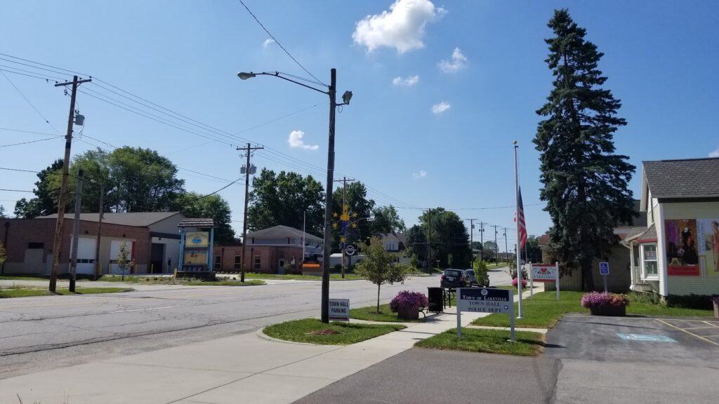
Downtown Lakeville Lakeville
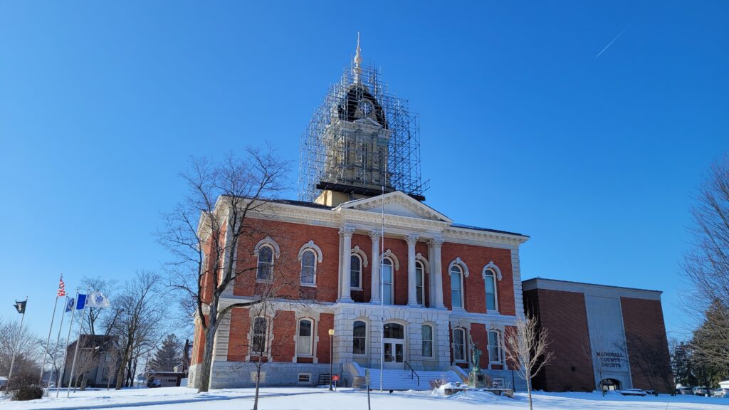
Marshall County Courthouse, Plymouth, Indiana Plymouth
Rochester
Logansport
Downtown Indianapolis Indianapolis
Martinsville
Bloomington
Bedford
Paoli
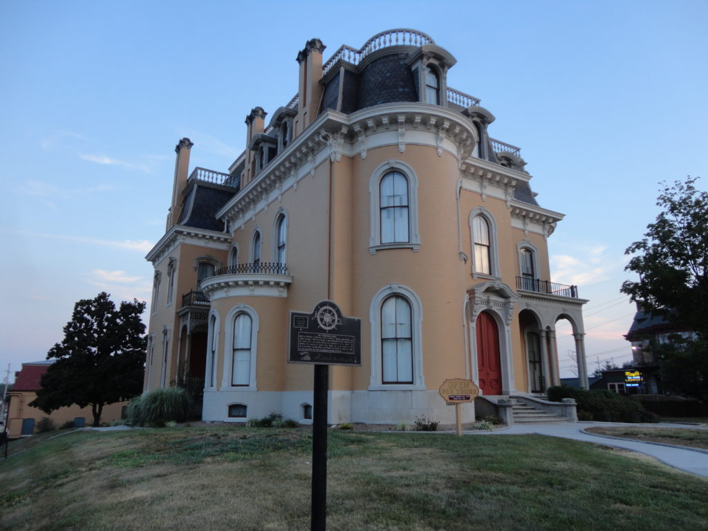
Culbertson Mansion State Historic Site, New Albany New Albany (Ohio River area )
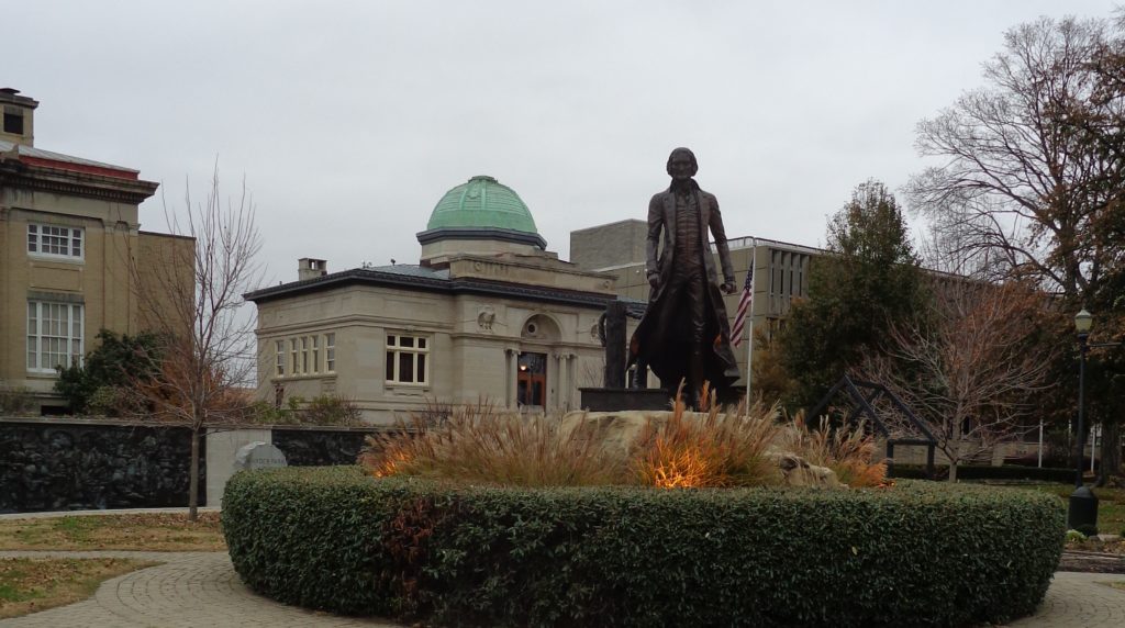
Thomas Jefferson statue, Warder Park, Jeffersonville, Indiana Jeffersonville (Ohio River area )
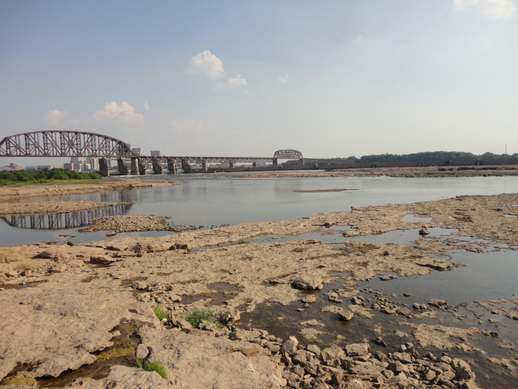
Falls of the Ohio State Park Falls of the Ohio State Park (Clarksville, Indiana) (Ohio River area )
Indiana-Kentucky state line (Ohio River)
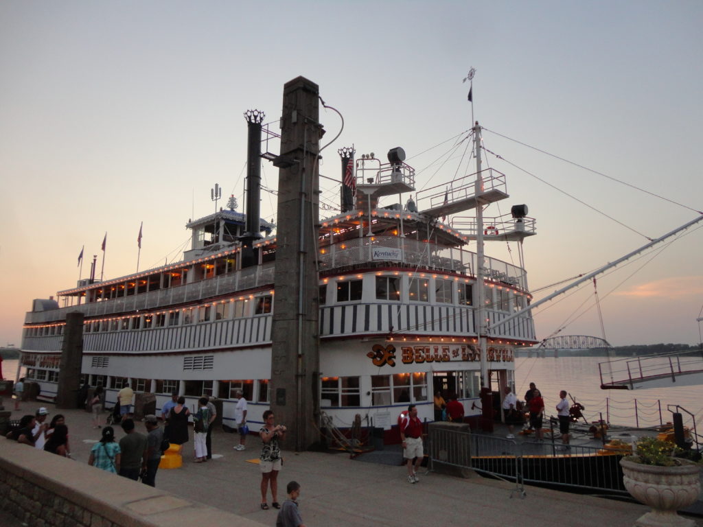
Belle of Louisville Louisville , Kentucky